New User? Avail 100Tk discount coupon


EMI Tenures for available banks
AB BANK PLC
Tenure EMI Charge 3 Months 3 % 6 Months 4.5 % 9 Months 6.5 % 12 Months 8.5 % 18 Months 11.5 % 24 Months 15.5 % 30 Months 16.5 % 36 Months 19.5 %
AL-ARAFAH ISLAMI BANK PLC
Tenure EMI Charge 3 Months 3 % 6 Months 4.5 % 9 Months 6.5 % 12 Months 8.5 % 18 Months 11.5 % 24 Months 15.5 % 36 Months 19.5 %
BANK ASIA PLC
Tenure EMI Charge 3 Months 3 % 6 Months 4.5 % 9 Months 6.5 % 12 Months 8.5 % 18 Months 11.5 % 24 Months 15.5 %
CITY BANK PLC
Tenure EMI Charge 3 Months 3 % 6 Months 4.5 % 9 Months 6.5 % 12 Months 8.5 % 18 Months 11.5 % 24 Months 15.5 % 30 Months 16.5 % 36 Months 19.5 %
COMMUNITY BANK PLC
Tenure EMI Charge 3 Months 3 % 6 Months 4.5 % 9 Months 6.5 % 12 Months 8.5 % 18 Months 11.5 % 24 Months 15.5 % 36 Months 19.5 %
DHAKA BANK PLC
Tenure EMI Charge 3 Months 3 % 6 Months 4.5 % 9 Months 6.5 % 12 Months 8.5 %
DUTCH-BANGLA BANK PLC
Tenure EMI Charge 3 Months 3 % 6 Months 4.5 % 9 Months 6.5 % 12 Months 8.5 % 18 Months 11.5 % 24 Months 15.5 % 36 Months 19.5 %
EASTERN BANK PLC
Tenure EMI Charge 3 Months 3 % 6 Months 4.5 % 9 Months 6.5 % 12 Months 8.5 % 18 Months 11.5 % 24 Months 15.5 % 36 Months 19.5 %
EXIM BANK PLC
Tenure EMI Charge 3 Months 3 % 6 Months 4.5 % 9 Months 6.5 % 12 Months 8.5 %
ISLAMI BANK PLC
Tenure EMI Charge 3 Months 3 % 6 Months 4.5 % 9 Months 6.5 % 12 Months 8.5 % 18 Months 11.5 % 24 Months 15.5 % 36 Months 19.5 %
JAMUNA BANK PLC
Tenure EMI Charge 3 Months 3 % 6 Months 4.5 % 9 Months 6.5 % 12 Months 8.5 % 18 Months 11.5 % 24 Months 15.5 % 36 Months 19.5 %
LANKABANGLA FINANCE PLC
Tenure EMI Charge 3 Months 3.5 % 6 Months 4.5 % 9 Months 6.5 % 12 Months 8.5 % 18 Months 11.5 % 24 Months 15.5 %
MEGHNA BANK PLC
Tenure EMI Charge 3 Months 3 % 6 Months 4.5 % 9 Months 6.5 % 12 Months 8.5 % 18 Months 11.5 % 24 Months 15.5 % 36 Months 19.5 %
MERCANTILE BANK PLC
Tenure EMI Charge 3 Months 3 % 6 Months 4.5 % 9 Months 6.5 % 12 Months 8.5 % 18 Months 11.5 % 24 Months 15.5 % 30 Months 16.5 % 36 Months 19.5 %
MIDLAND BANK PLC
Tenure EMI Charge 3 Months 3 % 6 Months 4.5 % 9 Months 6.5 % 12 Months 8.5 % 24 Months 15.5 %
MODHUMOTI BANK PLC
Tenure EMI Charge 3 Months 3 % 6 Months 4.5 % 9 Months 6.5 % 12 Months 8.5 % 18 Months 11.5 % 24 Months 15.5 %
MUTUAL TRUST BANK PLC
Tenure EMI Charge 3 Months 3 % 6 Months 4.5 % 9 Months 6.5 % 12 Months 8.5 % 18 Months 11.5 % 24 Months 15.5 % 36 Months 19.5 %
NCC BANK PLC
Tenure EMI Charge 3 Months 3 % 6 Months 4.5 % 9 Months 6.5 % 12 Months 8.5 % 18 Months 11.5 % 24 Months 15.5 % 36 Months 19.5 %
NRB BANK PLC
Tenure EMI Charge 3 Months 3 % 6 Months 4.5 % 9 Months 6.5 % 12 Months 8.5 % 18 Months 11.5 % 24 Months 15.5 % 36 Months 19.5 %
NRBC BANK PLC
Tenure EMI Charge 3 Months 3 % 6 Months 4.5 % 9 Months 6.5 % 12 Months 8.5 % 18 Months 11.5 % 24 Months 15.5 %
ONE BANK PLC
Tenure EMI Charge 3 Months 3 % 6 Months 4.5 % 9 Months 6.5 % 12 Months 8.5 %
PREMIER BANK PLC
Tenure EMI Charge 3 Months 3 % 6 Months 4.5 % 9 Months 6.5 % 12 Months 8.5 %
PRIME BANK PLC
Tenure EMI Charge 3 Months 3 % 6 Months 4.5 % 9 Months 6.5 % 12 Months 8.5 % 18 Months 11.5 % 24 Months 15.5 % 36 Months 19.5 %
PUBALI BANK PLC
Tenure EMI Charge 3 Months 3 % 6 Months 4.5 % 9 Months 6.5 % 12 Months 8.5 % 18 Months 11.5 % 24 Months 15.5 %
SBAC BANK PLC
Tenure EMI Charge 3 Months 3 % 6 Months 4.5 % 9 Months 6.5 % 12 Months 8.5 % 18 Months 11.5 % 24 Months 15.5 %
SHAHJALAL ISLAMI BANK PLC
Tenure EMI Charge 3 Months 3 % 6 Months 4.5 % 9 Months 6.5 % 12 Months 8.5 %
SOUTHEAST BANK PLC
Tenure EMI Charge 3 Months 3 % 6 Months 4.5 % 9 Months 6.5 % 12 Months 8.5 % 18 Months 11.5 % 24 Months 15.5 % 30 Months 16.5 % 36 Months 19.5 %
STANDARD BANK PLC
Tenure EMI Charge 3 Months 3 % 6 Months 4.5 % 9 Months 6.5 % 12 Months 8.5 % 18 Months 11.5 % 24 Months 15.5 %
STANDARD CHARTERED BANK
Tenure EMI Charge 3 Months 3.5 % 6 Months 5.5 % 9 Months 8 % 12 Months 10.5 % 18 Months 13.5 % 24 Months 17.5 % 36 Months 22.5 %
TRUST BANK PLC
Tenure EMI Charge 3 Months 3 % 6 Months 4.5 % 9 Months 6.5 % 12 Months 8.5 % 18 Months 11.5 % 24 Months 15.5 % 36 Months 19.5 %
UNITED COMMERCIAL BANK PLC
Tenure EMI Charge 3 Months 3 % 6 Months 4.5 % 9 Months 6.5 % 12 Months 8.5 % 24 Months 15.5 %
[**Due to high call volumes during this World Cup season, we are currently unable to take all phone calls. Please leave a message or email here, for any order information, we'll reply as soon as possible.
Thank you for your patience.]
Inside Dhaka: From next day to 3 business days.
*Inside Dhaka North and South City Corporation.
Outside Dhaka: From next day to 5 business days.
**Home Delivery/Courier Delivery. Learn More
Inside Dhaka: Starts from 60Tk.
**Inside Dhaka North and South City Corporation.
Outside Dhaka: Starts from 100Tk.
**Home Delivery/Courier Delivery. Learn More
Spend TK.5000 or more and pay in 3 to 36 months EMI.
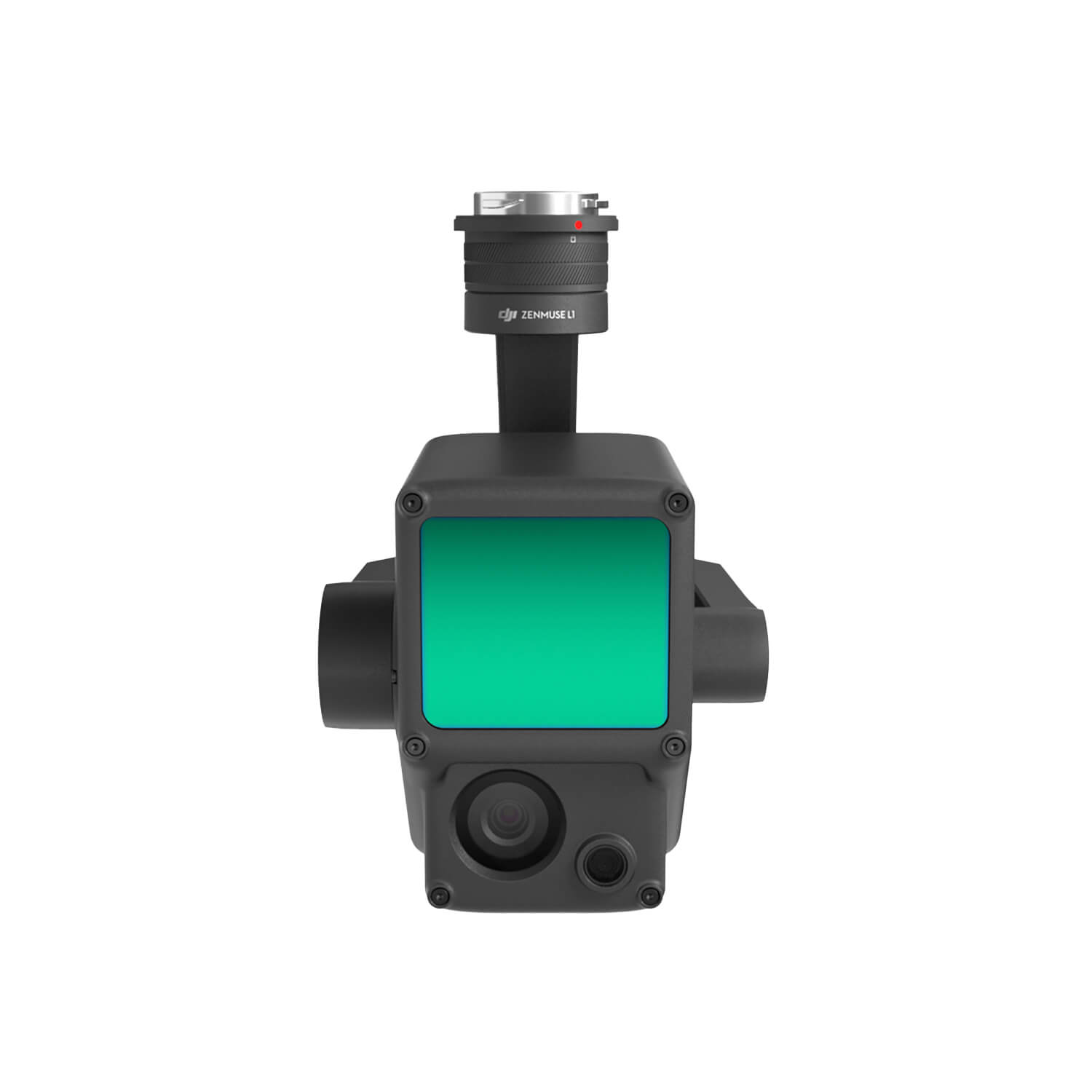
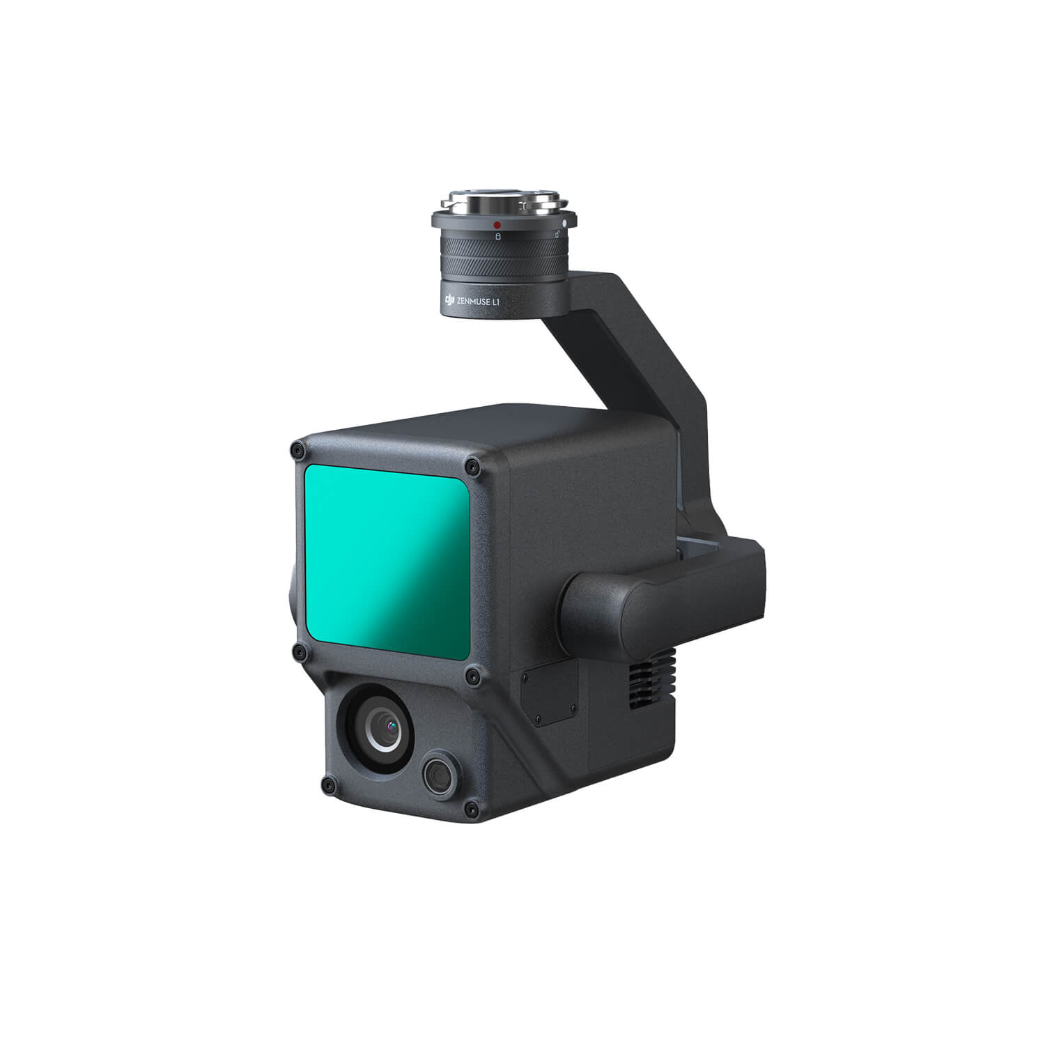
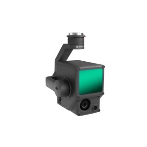
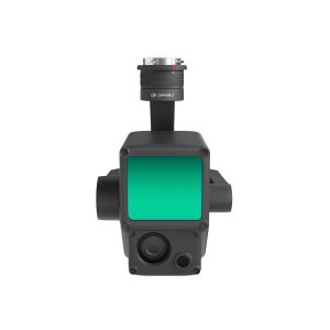
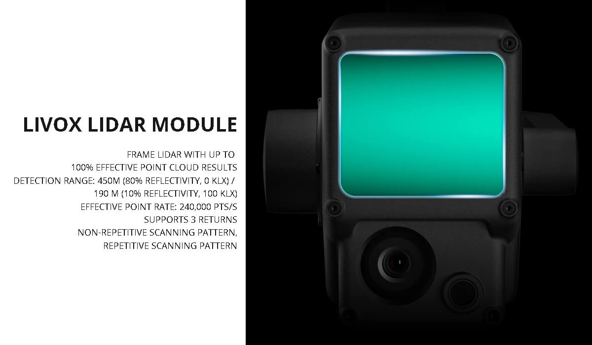
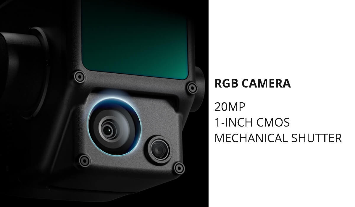
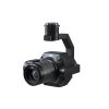
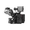
Zenmuse L1 Gimbal Camera. Instant Clarity. Superior Accuracy. A Lidar + RGB Solution for Aerial Surveying. The Zenmuse L1 integrates a Livox Lidar module, a high-accuracy IMU, and a camera with a 1-inch CMOS on a 3-axis stabilized gimbal. When used with Matrice 300 RTK and DJI Terra, the L1 forms a complete solution that gives you real-time 3D data throughout the day, efficiently capturing the details of complex structures and delivering highly accurate reconstructed models.
Generate true-color point cloud models in real-time, or acquire 2 km2 of point cloud data in a single flight using the Livox frame Lidar module with a 70° FOV and a visible light camera with a 1-inch sensor.
Render centimeter-accurate reconstructions thanks to the high-accuracy IMU, a vision sensor for positioning accuracy, and the incorporation of GNSS data.
The IP54 rating allows the L1 to be operated in rainy or foggy environments. The Lidar module’s active scanning method enables you to fly at night.
Livox Lidar Module
RGB Camera
High-accuracy IMU
Topographic Mapping
Quickly generate topographic maps using accurate digital elevation models.
AEC and Surveying
Manage the full project lifecycle using highly accurate point clouds and 3D models.
Emergency Response
Any time of the day, gather critical insights in real-time using true-color point clouds.
Law Enforcement
Gain situational awareness and forensic intel in real-time to make informed decisions on site.
Energy and Infrastructure
Model sparse or complex structures in detail to manage them efficiently and safely.
Agriculture and Forestry Management
Gain insight into vegetation density, area, stock volume, canopy width, and growth trends.
Notes
See more drone camera
We do not sell any replica products. We believe in quality. Not in quantity.
Call for any enquiry: +8801302555180; +8801798740472.


Reviews
There are no reviews yet.