New User? Avail 100Tk discount coupon

EMI Tenures for available banks
AB BANK PLC
Tenure EMI Charge 3 Months 3 % 6 Months 4.5 % 9 Months 6.5 % 12 Months 8.5 % 18 Months 11.5 % 24 Months 15.5 % 30 Months 16.5 % 36 Months 19.5 %
AL-ARAFAH ISLAMI BANK PLC
Tenure EMI Charge 3 Months 3 % 6 Months 4.5 % 9 Months 6.5 % 12 Months 8.5 % 18 Months 11.5 % 24 Months 15.5 % 36 Months 19.5 %
BANK ASIA PLC
Tenure EMI Charge 3 Months 3 % 6 Months 4.5 % 9 Months 6.5 % 12 Months 8.5 % 18 Months 11.5 % 24 Months 15.5 %
CITY BANK PLC
Tenure EMI Charge 3 Months 3 % 6 Months 4.5 % 9 Months 6.5 % 12 Months 8.5 % 18 Months 11.5 % 24 Months 15.5 % 30 Months 16.5 % 36 Months 19.5 %
COMMUNITY BANK PLC
Tenure EMI Charge 3 Months 3 % 6 Months 4.5 % 9 Months 6.5 % 12 Months 8.5 % 18 Months 11.5 % 24 Months 15.5 % 36 Months 19.5 %
DHAKA BANK PLC
Tenure EMI Charge 3 Months 3 % 6 Months 4.5 % 9 Months 6.5 % 12 Months 8.5 %
DUTCH-BANGLA BANK PLC
Tenure EMI Charge 3 Months 3 % 6 Months 4.5 % 9 Months 6.5 % 12 Months 8.5 % 18 Months 11.5 % 24 Months 15.5 % 36 Months 19.5 %
EASTERN BANK PLC
Tenure EMI Charge 3 Months 3 % 6 Months 4.5 % 9 Months 6.5 % 12 Months 8.5 % 18 Months 11.5 % 24 Months 15.5 % 36 Months 19.5 %
EXIM BANK PLC
Tenure EMI Charge 3 Months 3 % 6 Months 4.5 % 9 Months 6.5 % 12 Months 8.5 %
ISLAMI BANK PLC
Tenure EMI Charge 3 Months 3 % 6 Months 4.5 % 9 Months 6.5 % 12 Months 8.5 % 18 Months 11.5 % 24 Months 15.5 % 36 Months 19.5 %
JAMUNA BANK PLC
Tenure EMI Charge 3 Months 3 % 6 Months 4.5 % 9 Months 6.5 % 12 Months 8.5 % 18 Months 11.5 % 24 Months 15.5 % 36 Months 19.5 %
LANKABANGLA FINANCE PLC
Tenure EMI Charge 3 Months 3.5 % 6 Months 4.5 % 9 Months 6.5 % 12 Months 8.5 % 18 Months 11.5 % 24 Months 15.5 %
MEGHNA BANK PLC
Tenure EMI Charge 3 Months 3 % 6 Months 4.5 % 9 Months 6.5 % 12 Months 8.5 % 18 Months 11.5 % 24 Months 15.5 % 36 Months 19.5 %
MERCANTILE BANK PLC
Tenure EMI Charge 3 Months 3 % 6 Months 4.5 % 9 Months 6.5 % 12 Months 8.5 % 18 Months 11.5 % 24 Months 15.5 % 30 Months 16.5 % 36 Months 19.5 %
MIDLAND BANK PLC
Tenure EMI Charge 3 Months 3 % 6 Months 4.5 % 9 Months 6.5 % 12 Months 8.5 % 24 Months 15.5 %
MODHUMOTI BANK PLC
Tenure EMI Charge 3 Months 3 % 6 Months 4.5 % 9 Months 6.5 % 12 Months 8.5 % 18 Months 11.5 % 24 Months 15.5 %
MUTUAL TRUST BANK PLC
Tenure EMI Charge 3 Months 3 % 6 Months 4.5 % 9 Months 6.5 % 12 Months 8.5 % 18 Months 11.5 % 24 Months 15.5 % 36 Months 19.5 %
NCC BANK PLC
Tenure EMI Charge 3 Months 3 % 6 Months 4.5 % 9 Months 6.5 % 12 Months 8.5 % 18 Months 11.5 % 24 Months 15.5 % 36 Months 19.5 %
NRB BANK PLC
Tenure EMI Charge 3 Months 3 % 6 Months 4.5 % 9 Months 6.5 % 12 Months 8.5 % 18 Months 11.5 % 24 Months 15.5 % 36 Months 19.5 %
NRBC BANK PLC
Tenure EMI Charge 3 Months 3 % 6 Months 4.5 % 9 Months 6.5 % 12 Months 8.5 % 18 Months 11.5 % 24 Months 15.5 %
ONE BANK PLC
Tenure EMI Charge 3 Months 3 % 6 Months 4.5 % 9 Months 6.5 % 12 Months 8.5 %
PREMIER BANK PLC
Tenure EMI Charge 3 Months 3 % 6 Months 4.5 % 9 Months 6.5 % 12 Months 8.5 %
PRIME BANK PLC
Tenure EMI Charge 3 Months 3 % 6 Months 4.5 % 9 Months 6.5 % 12 Months 8.5 % 18 Months 11.5 % 24 Months 15.5 % 36 Months 19.5 %
PUBALI BANK PLC
Tenure EMI Charge 3 Months 3 % 6 Months 4.5 % 9 Months 6.5 % 12 Months 8.5 % 18 Months 11.5 % 24 Months 15.5 %
SBAC BANK PLC
Tenure EMI Charge 3 Months 3 % 6 Months 4.5 % 9 Months 6.5 % 12 Months 8.5 % 18 Months 11.5 % 24 Months 15.5 %
SHAHJALAL ISLAMI BANK PLC
Tenure EMI Charge 3 Months 3 % 6 Months 4.5 % 9 Months 6.5 % 12 Months 8.5 %
SOUTHEAST BANK PLC
Tenure EMI Charge 3 Months 3 % 6 Months 4.5 % 9 Months 6.5 % 12 Months 8.5 % 18 Months 11.5 % 24 Months 15.5 % 30 Months 16.5 % 36 Months 19.5 %
STANDARD BANK PLC
Tenure EMI Charge 3 Months 3 % 6 Months 4.5 % 9 Months 6.5 % 12 Months 8.5 % 18 Months 11.5 % 24 Months 15.5 %
STANDARD CHARTERED BANK
Tenure EMI Charge 3 Months 3.5 % 6 Months 5.5 % 9 Months 8 % 12 Months 10.5 % 18 Months 13.5 % 24 Months 17.5 % 36 Months 22.5 %
TRUST BANK PLC
Tenure EMI Charge 3 Months 3 % 6 Months 4.5 % 9 Months 6.5 % 12 Months 8.5 % 18 Months 11.5 % 24 Months 15.5 % 36 Months 19.5 %
UNITED COMMERCIAL BANK PLC
Tenure EMI Charge 3 Months 3 % 6 Months 4.5 % 9 Months 6.5 % 12 Months 8.5 % 24 Months 15.5 %
[**Due to high call volumes during this World Cup season, we are currently unable to take all phone calls. Please leave a message or email here, for any order information, we'll reply as soon as possible.
Thank you for your patience.]
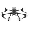
Visionary Intelligence. Elevated Accuracy.
Inside Dhaka: From next day to 3 business days.
*Inside Dhaka North and South City Corporation.
Outside Dhaka: From next day to 5 business days.
**Home Delivery/Courier Delivery. Learn More
Inside Dhaka: Starts from 60Tk.
**Inside Dhaka North and South City Corporation.
Outside Dhaka: Starts from 100Tk.
**Home Delivery/Courier Delivery. Learn More
Spend TK.5000 or more and pay in 3 to 36 months EMI.
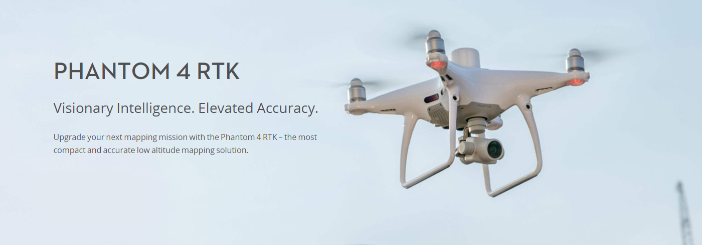
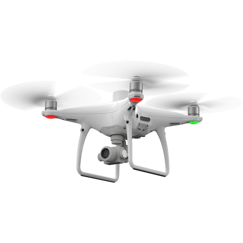
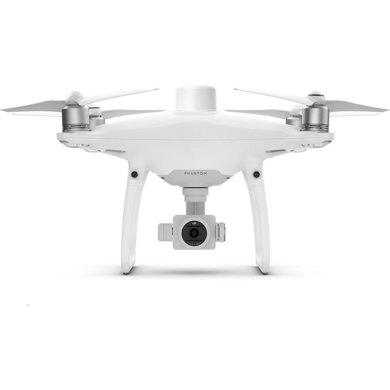
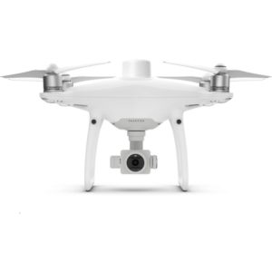
Upgrade your next mapping mission with the DJI Phantom 4 RTK – the most compact and accurate low altitude mapping solution.

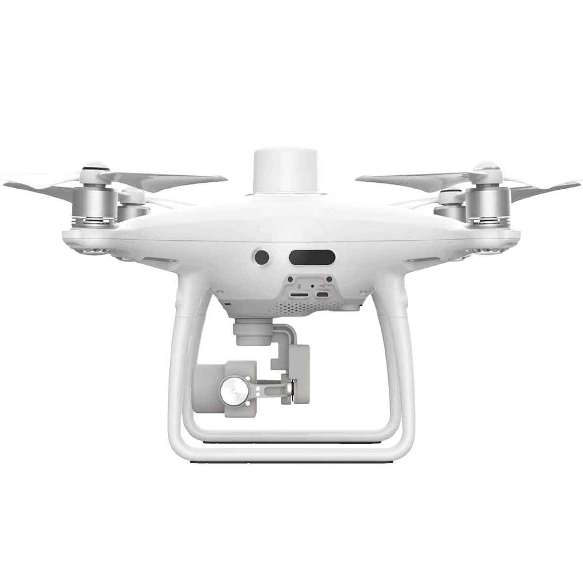
DJI Phantom 4 RTK has rethought its drone technology from the ground-up, revolutionizing its systems to achieve a new standard for drone accuracy – offering Phantom 4 RTK customers centimeter-accurate data while requiring fewer ground control points.
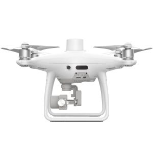
A new RTK module is integrated directly into the Phantom 4 RTK, providing real-time, centimeter-level positioning data for improved absolute accuracy on image metadata. In addition to optimized flight safety and precise data collection, the Phantom 4 RTK stores satellite observation data to be used for Post Processed Kinematics (PPK), which can be conducted using DJI Cloud PPK Service*. Fit the Phantom 4 RTK to any workflow, with the ability to connect this positioning system to the D-RTK 2 High Precision GNSS Mobile Station, or NTRIP (Network Transport of RTCM via Internet Protocol) using a 4G dongle or Wi-Fi hotspot.
To take full advantage of the Phantom 4 RTK’s positioning modules, the new TimeSync system was created to continually align the flight controller, camera and RTK module. Additionally, TimeSync ensures each photo uses the most accurate metadata and fixes the positioning data to optical center of the lens – optimizing the results from photogrammetric methods and letting the image achieve centimeter-level positioning data.
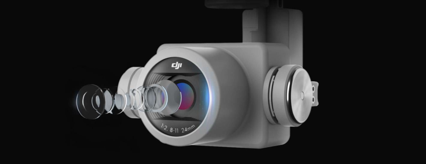
Capture the best image data with a 1-inch, 20-megapixel CMOS sensor. Mechanical shutter makes mapping missions or regular data capture seamless as the Phantom 4 RTK can move while taking pictures without the risk of rolling shutter blur. Due to the high resolution, the Phantom 4 RTK can achieve a ground sample distance (GSD) of 2.74 cm at 100 meters flight altitude.To ensure each Phantom 4 RTK offers unparalleled accuracy, every single camera lens goes through a rigorous calibration process, with parameters saved into each image’s metadata, letting post-processing software adjust uniquely for every user.
Offering a range of control schemes and complimentary technologies, the DJI Phantom 4 RTK is developed to provide survey-grade results with greater efficiency than ever before.
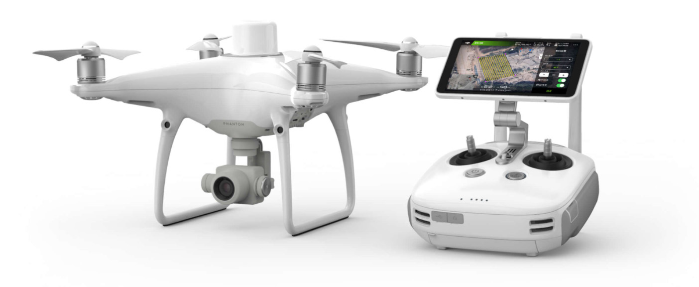
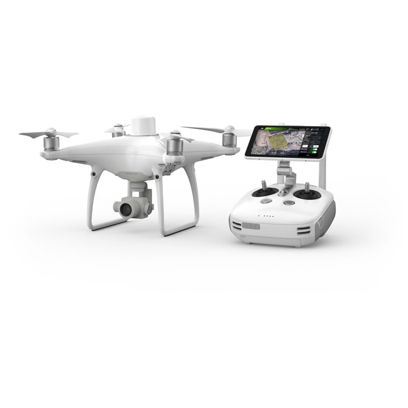
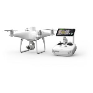
A new DJI GS RTK app and Remote Controller with built-in screen, giving users a streamlined control scheme for surveying missions and other data acquisition scenarios. The GS RTK app allows pilots to intelligently control their Phantom 4 RTK, with multiple planning modes, including Photogrammetry (2D and 3D), Waypoint Flight, Terrain Awareness, Block Segmentation*, and more. Users can also import KML/KMZ files to optimize the workflow for their missions. With the built-in screen, pilots can clearly view and plan their missions on an ultra-bright, 5.5-inch HD display.
Pilots with experience using 3rd party apps on DJI drones can access the world’s leading drone app ecosystem for their Phantom 4 RTK with the SDK Remote Controller. Users can plug in a compatible Android or iOS device and install any compatible DJI Mobile SDK-enabled app to harness the full power of their Phantom 4 RTK.
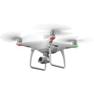
Enjoy stable and reliable HD image and video transmission at distances of up to 7 km, great for mapping larger sites*.
*Unobstructed, free of interference, when FCC compliant. Maximum flight range specification is a proxy for radio link strength and resilience. Always fly your drone within visual line of sight unless otherwise permitted.
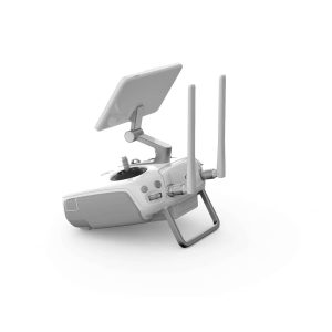
Support your Phantom 4 RTK missions with the D-RTK 2 Mobile Station – providing real-time differential data to the drone and forming an accurate surveying solution, or acquire accurate location coordinates when used as an RTK rover. The Mobile Station’s rugged design and OcuSync transmission system ensures you can gain centimeter-level accurate data with your Phantom 4 RTK in any condition.
With a built-in flight planning app (GS RTK) and an easy method to collect RTK data (RTK Network or D-RTK 2 Mobile Station), pilots have a full solution for any surveying, mapping or inspection workflow – right out of the box.
| Takeoff Weight | 1391 g |
| Diagonal Distance | 350 mm |
| Max Service Ceiling Above Sea Level | 19685 ft (6000 m) |
| Max Ascent Speed | 6 m/s (automatic flight); 5 m/s (manual control) |
| Max Descent Speed | 3 m/s |
| Max Speed | 31 mph (50 kph) (P-mode) 36 mph (58 kph) (A-mode) |
| Max Flight Time | Approx. 30 minutes |
| Operating Temperature Range | 32° to 104° F (0° to 40℃) |
| Operating Frequency | 2.400 GHz to 2.483 GHz (Europe, Japan, Korea) 5.725 GHz to 5.850 GHz (United States, China) |
| Transmission Power (EIRP) | 2.4 GHz CE (Europe) / MIC (Japan) / KCC (Korea) :< 20 dBm5.8 GHz SRRC(China) / FCC(United States)/NCC(Taiwan,China):< 26 dBm |
| Hover Accuracy Range | RTK enabled and functioning properly: Vertical:±0.1 m;Horizontal:±0.1 mRTK disabled Vertical:±0.1 m(with vision positioning ); ±0.5 m(with GNSS positioning) Horizontal:±0.3 m(with vision positioning); ±1.5 m(with GNSS positioning) |
| Image Position Offset | The position of the camera center is relative to the phase center of the onboard D-RTK antenna under the aircraft body’s axis:(36, 0, and 192 mm) already applied to the image coordinates in Exif data. The positive x, y, and z axes of the aircraft body point to the forward, rightward, and downward of the aircraft, respectively. |
| Mapping Accuracy | Mapping accuracy meets the requirements of the ASPRS Accuracy Standards for Digital Orthophotos Class Ⅲ ** The actual accuracy depends on surrounding lighting and patterns, aircraft altitude, mapping software used, and other factors when shooting. |
| Ground Sample Distance (GSD) | (H/36.5) cm/pixel, H means the aircraft altitude relative to shooting scene (unit: m) |
| Data Acquisition Efficiency | Max operating area of approx. 1 km² for a single flight (at an altitude of 182 m, i.e., GSD is approx. 5 cm/pixel, meeting the requirements of the ASPRS Accuracy Standards for Digital Orthophotos Class Ⅲ |
| Velocity Range | ≤31 mph (50 kph) at 6.6 ft (2 m) above ground with adequate lighting |
| Altitude Range | 0-33 ft (0 – 10 m) |
| Operating Range | 0-33 ft (0 – 10 m) |
| Obstacle Sensing Range | 2-98 ft (0.7-30 m) |
| FOV | Forward/Rear: 60° (horizontal), ±27° (vertical) Downward: 70° (front and rear), 50° (left and right) |
| Measuring Frequency | Forward/Rear:10 Hz; Downward: 20 Hz |
| Operating Environment | Surfaces with clear patterns and adequate lighting (> 15 lux) |
| Sensor | 1″ CMOS; Effective pixels: 20 M |
| Lens | FOV 84°;8.8 mm / 24 mm (35 mm format equivalent:24 mm); f/2.8 – f/11, auto focus at 1 m – ∞ |
| ISO Range | Video:100-3200(Auto) 100-6400(Manual);Photo:100-3200(Auto) 100-12800(Manual) |
| Mechanical Shutter Speed | 8 – 1/2000 s |
| Electronic Shutter Speed | 8 – 1/8000 s |
| Max Image Size | 4864×3648(4:3; 5472×3648(3:2) |
| Video Recording Modes | H.264,4K:3840×2160 30p |
| Photo Format | JPEG |
| Video Format | MOV |
| Supported File Systems | FAT32(≤ 32 GB); exFAT(> 32 GB) |
| Supported SD Cards | MicroSD, Max Capacity: 128 GB. Class 10 or UHS-1 rating required Write speed≥15 MB/s |
| Operating Temperature Range | 32° to 104° F (0° to 40℃) |
| Capacity | 5870 mAh |
| Voltage | 15.2 V |
| Battery Type | LiPo 4S |
| Energy | 89.2 Wh |
| Net Weight | 468 g |
| Charging Temperature Range | 14° to 104℉ (-10° to 40℃) |
| Max charging Power | 160 W |
| Input Voltage | 17.3 – 26.2 V |
| Output Voltage and Current | 8.7 V,6 A;5 V,2 A |
| Operating Temperature | 41° to 104℉ (5° to 40℃) |
| Operating Frequency | 2.400 GHz to 2.483 GHz (Europe, Japan, Korea) 5.725 GHz to 5.850 GHz (Other countries/regions) |
| EIRP | 2.4 GHz CE / MIC / KCC: < 20 dBm5.8 GHz FCC / SRRC / NCC: < 26 dBm |
| Max Transmission Distance | FCC / NCC: 4.3 mi (7 km); CE / MIC / KCC / SRRC: 3.1 mi (5 km) (Unobstructed, free of interference) |
| Built-in Battery | 6000 mAh LiPo 2S |
| Operating Current / Voltage | 1.2 A @ 7.4 V |
| Mobile Device Holder | Tablets and smartphones |
| Operating Temperature | 32° to 104° F (0° to 40° C) |
| Single-Frequency, High-Sensitivity GNSS Module | GPS+BeiDou+Galileo(Asia) GPS+GLONASS+Galileo(other regions) |
| Multi-Frequency Multi-System High-Precision RTK GNSS | Frequency Used: GPS:L1/L2; GLONASS:L1/L2; BeiDou:B1/B2; Galileo:E1/E5aFirst-Fixed Time:< 50 sPositioning Accuracy: Vertical 1.5 cm + 1 ppm(RMS); Horizontal 1 cm + 1 ppm(RMS) 1 ppm means the error has a 1mm increase for every 1 km of movement from the aircraft. |
| Stabilization | 3-axis (tilt, roll, yaw) |
| Pitch | -90° to +30° |
| Max Controllable Angular Speed | 90°/s |
| Angular Vibration Range | ±0.02° |
| Obstacle Sensing Range | 0.6-23 ft(0.2 – 7 m) |
| FOV | 70°(Horizontal) ±10°(Vertical) |
| Measuring Frequency | 10 Hz |
| Operating Environment | Surface with diffuse reflection material, and reflectivity> 8%(such as wall, trees, humans, etc.) |
| Operating Frequency | 2.400 GHz-2.483 GHz (Europe,Japan,Korea) 5.725 GHz-5.850 GHz (United States, China) |
| Transmission Power (EIRP) | 2.4 GHz CE / MIC / KCC:< 20 dBm5.8 GHz SRRC / FCC:< 26 dBm |
| Max Transmission Distance | FCC:4.3 mi (7 km); SRRC / CE / MIC / KCC:3.1 mi(5 km) (Unobstrcted, free of interference) |
| Power Consumption | 16 W (typical value) |
| Display | 5.5 inch screen, 1920×1080, 1000 cd/m², Android System Memory 4G RAM+16G ROM |
| Operating Temperature Range | 32° to 104° F (0° to 40℃) |
| Voltage | 17.5 V |
| Operating Temperature Range | 41° to 104℉ (5° to 40℃) |
| Capacity | 4920 mAh |
| Voltage | 7.6 V |
| Battery Type | LiPo 2S |
| Energy | 37.39 Wh |
| Operating Temperature | -4° to 104℉(-20° to 40℃) |
| Voltage | 17.4 V |
| Rated Power | 160 W |
Aircraft Body × 1
Remote Controller × 1
Propeller Pair × 4
Intelligent Flight Battery × 2
AC Power Cable × 1
WB37 Remote Controller Intelligent Battery × 1
AC Power Adapter × 1
Intelligent Battery Charging Hub × 1
Intelligent Flight Battery Charging Hub × 1
Gimbal Clamp × 1
MicroSD Card (16GB) × 1
Carrying Case × 1
Micro USB Cable × 1
USB-C Cable × 1
USB-C OTG Cable × 1
Phillips Screw × 2
See more drone camera
We do not sell any replica products. We believe in quality. Not in quantity.
Call for any enquiry: +8801302555180; +8801752771463


Reviews
There are no reviews yet.